
Enhance surveying efficiency and accuracy with real-time geospatial solutions. Access up-to-date data, collaborate seamlessly, and generate professional reports with GeoPoints by Wolf Logic. Maximize Efficiency and Accuracy in Surveying with Real-Time Geospatial Solutions
In today’s data-driven world, Geographic Information Systems (GIS) have become essential for businesses looking to make informed, location-based decisions. GIS technology allows organizations to capture, analyse, and visualise spatial data, offering powerful insights that can enhance everything from project planning to strategic development.
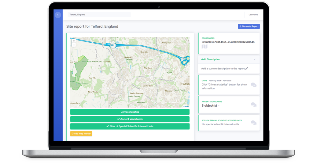
For surveying professionals, having access to accurate and up-to-date geospatial data is critical. Moreover, That’s where GeoPoints, a bespoke solution developed by Wolf Logic, comes in. Furthermore, GeoPoints streamlines data handling and collaboration, tailoring its features to support the specific needs of modern projects.
Why Choose GeoPoints?
Real-time Data Access: Get the geospatial data you need, when you need it, with up-to-the-minute accuracy.
Collaborative Tools: Furthermore, GeoPoints enables teams to work together more efficiently, with features that simplify workflow management and ensure everyone stays aligned.
Consistent PDF Reporting: Moreover, Generate professional reports easily and share them with clients and stakeholders, making data presentation seamless and reliable.
Tailored Solutions: Built by Wolf Logic, GeoPoints is customised to fit your project’s unique requirements, providing a solution that adapts to your specific needs.
Whether you’re overseeing a large-scale infrastructure project or conducting detailed land surveys, GeoPoints gives you the tools to capture and manage spatial data effortlessly. With its combination of real-time data, collaboration features, and tailored reporting, GeoPoints can take your surveying expertise to the next level.
Discover how GeoPoints can transform your next project. Learn more at GeoPoints


Leave a Reply