Geospatial & GIS Integration Services
Are you looking to centralise important Geospatial and Mapping data in one shareable portal? Whether it’s a system to share reports with clients on the fly, or share internal data with colleagues, merging web & mobile technologies with existing datasets can unlock a whole new world.
Utilising Geospatial, GIS & Mapping
We are a team of Software Developers who focus on specific sectors and aim to solve real world problems using our wealth of experience and knowledge.
We have created a modular online portal that allows any organisation to customise the interface and integrate their business processes. This platform is called Geo Points and can be used to fulfil existing processes and datasets or as a sandbox area for testing out Enterprise needs that will give a huge return on investment.


“Besides offering a wealth of technical expertise, they have a passion for technology which means they are extremely pro-active. Wolf Logic has developed a business management platform for us to easily look after our database.”
Ben Hartley – Carterwood
Mapping the UK Railway Network
One of our clients who runs an established survey company had the need to bring together datasets that would help accelerate their site assessments for upcoming jobs. This meant bringing in Geospatial and Mapping together into one portal where users could quickly generate site reports based on the information they wished to be presented.
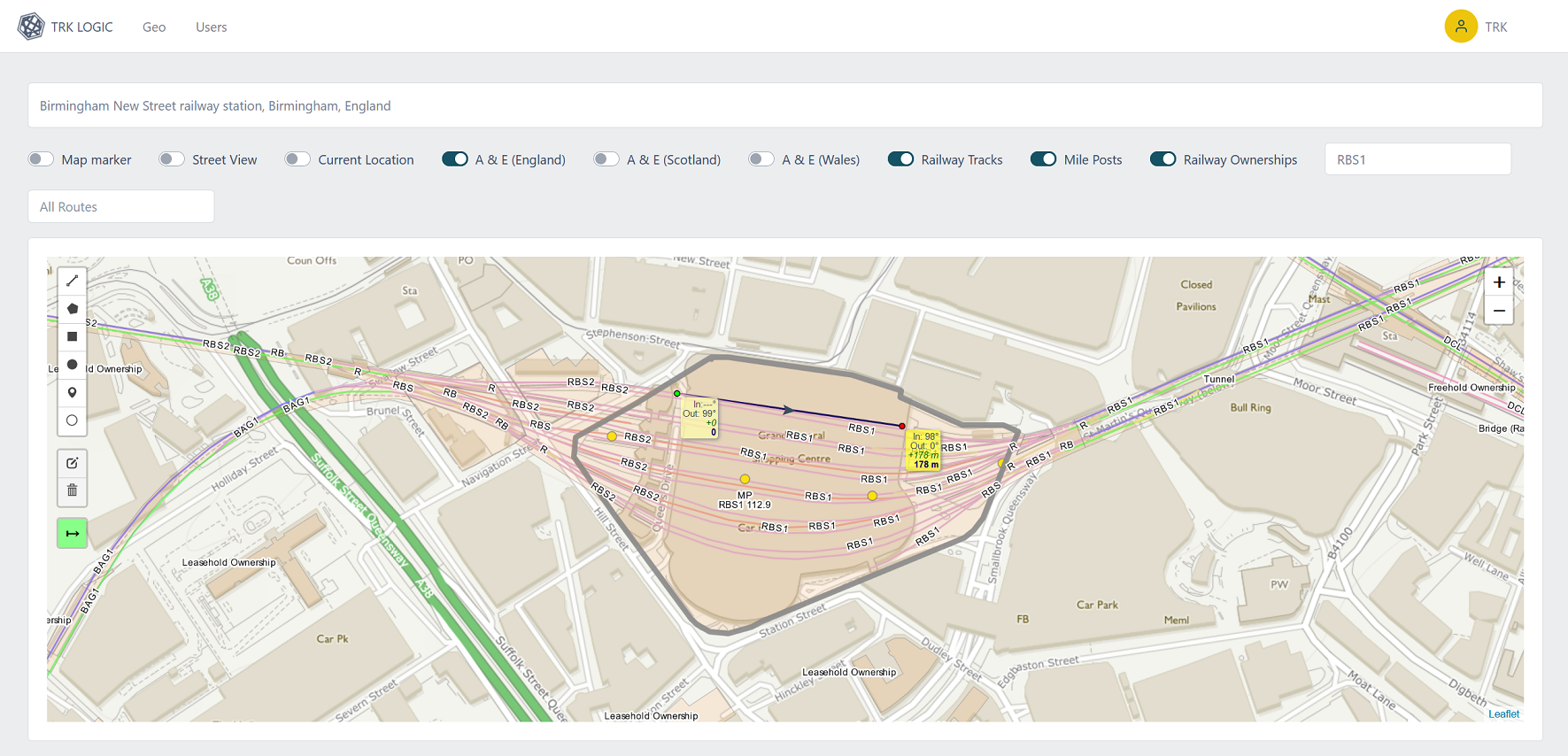
A case study on this project can be found under the “Mapping the UK Rail Network”
Centralise your Geospatial & Mapping needs
Please click below to contact us and we will listen and show you how to harness your data and processes by using our tried and test methods.
Rigorous Processes & Software Development
We provide consulting and software development services for organisations who know the importance of keeping pace with current technologies and storage of Geospatial data.
Our projects always start with a discovery phase and we have the option to implement legacy functionality into our cutting edge platforms. Alternatively if you’re unsure on your next move, we have a Geospatial & Mapping Sandbox called Geo Points. This is a cost effective platform that allows you to rapidly test ideas whilst not risking the departments budget.
We follow our own internal processes that bring rigour to every project, no matter the size.
Discuss your ideas with our team
Whether your project is blue sky or a prototype, we have several processes that can bring ideas and existing projects to fruition whilst capturing important stakeholder requirements and asking the questions that may not have been asked yet.
Once engaged with our team you will be taken through a development journey that captures the importance and goals of the project. The outcome will be measured against the initial requirements so you will know what to expect every step of the way.
Get in touch with our business analysts using the contact form and our team will be happy to discuss your needs.